| Wind Energy | 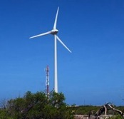 |
|||||
| Wind Energy in Indiana | ||||||
| Start with the DOE EERE resource on wind energy. You can download the 20% Wind Energy by 2030 booklet. From here you can also look up the wind speeds in any state including Indiana of course. It is interesting to compare Indiana's wind map to a state like Kansas. | ||||||
| The Indiana map shows areas of the state rated according to average wind speeds at a height of 50 meters starting from Class 1 (lowerst) to Class 7 (highest). Essentially all of Indiana south of Indianapolis is Class 1. Benton county, which is on the border with Illinois and about 90 miles northwest of Indianapolis, has a Class 3 rating - the highest for Indiana.
There are two large wind farms in Benton county, the Earl Park Wind Farm (also called the Benton Wind Farm) near Earl, IN and the Fowler Ridge Wind Farm located near Fowler, IN. The Earl Park Wind Farm (see photos here) has 87 1.5 MW GE wind turbines with a total capacity of 130 MW. The Fowler Ridge Wind park has 182 turbines with a total capacity of 400 MW with plans to expand to 750 MW. A local TV station (WLFI) near Fowler has an interesting video showing maintenance work on one of the turbines. Comparing Benton County to Southern Indiana: According to the Indiana wind map, the average speeds in Benton County are about 2.3 times higher than in southern Indiana. Since the power in the wind goes like the cube power of the wind speed, the wind power in southern Indiana is about 12 times less than in Benton county. A nice explanation for why the power depends on the cube power of velocity is given here. |
||||||